
CORA carries out graphic support to publishers, such as maps, historical maps, synoptic tables, illustrations, diagrams.
CORA, that means territory, is the transcription from ancient Greek into Latin script of the word:
.
HIKING

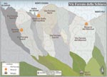
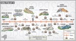
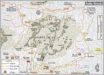
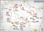
Dolomites
Six maps published in the book “Sentieri e Rifugi” (Huts and Hiking), of the box “Dolomiti Patrimonio dell'Umanità” (Dolomites World Heritage), edited by Panorama - Trento.

Click on thumbnails to enlarge the boards. Click on titles to download high-resolution versions:
22x12/16/32 cm - 624x332/454/907 px - about 2/5 mb.
Downloaded data, and their intellectual content, are protected by international copyright laws: consulting, storage and distribution for personal non-commercial use only.

Offer
Your first plate
for FREE!